


210617 - Mont Lozère

randodan
User
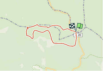

Length
7.1 km

Max alt
1699 m

Uphill gradient
169 m
Km-Effort
9.3 km

Min alt
1539 m

Downhill gradient
167 m
Boucle
Yes
Creation date :
2021-06-17 08:13:26.287
Updated on :
2021-06-17 14:27:58.831
1h22
Difficulty : Easy

FREE GPS app for hiking
 SityTrail
IGN / Geographical institutes
SityTrail Plus
The world is yours!
About
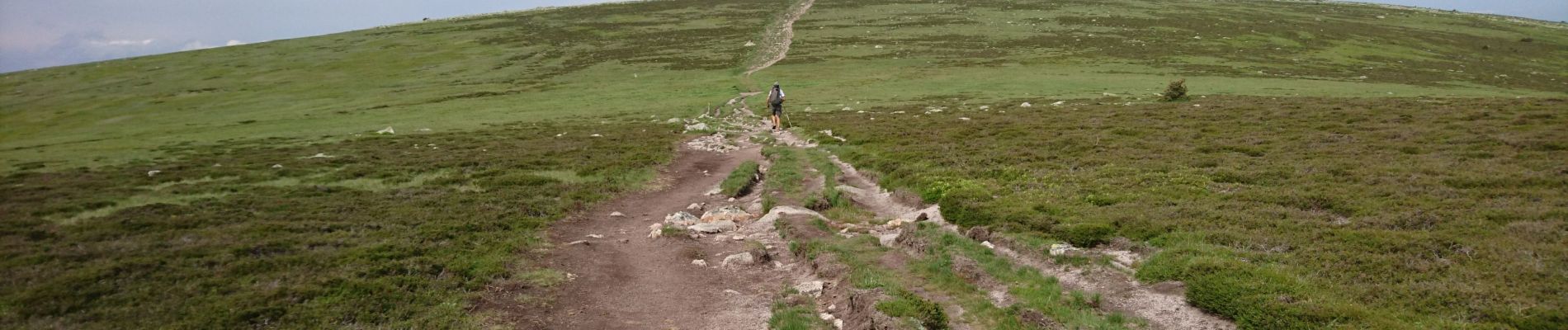
Trail Walking of 7.1 km to be discovered at Occitania, Lozère, Mont Lozère et Goulet. This trail is proposed by randodan.
Description
D'après le circuit 26082020 de Amourette que je remercie.
Belle petite rando, facile, agréable même par temps couvert.
Photos


Positioning
Country:
France
Region :
Occitania
Department/Province :
Lozère
Municipality :
Mont Lozère et Goulet
Location:
Mas-d'Orcières
Start:(Dec)
Start:(UTM)
561167 ; 4919274 (31T) N.
Comments